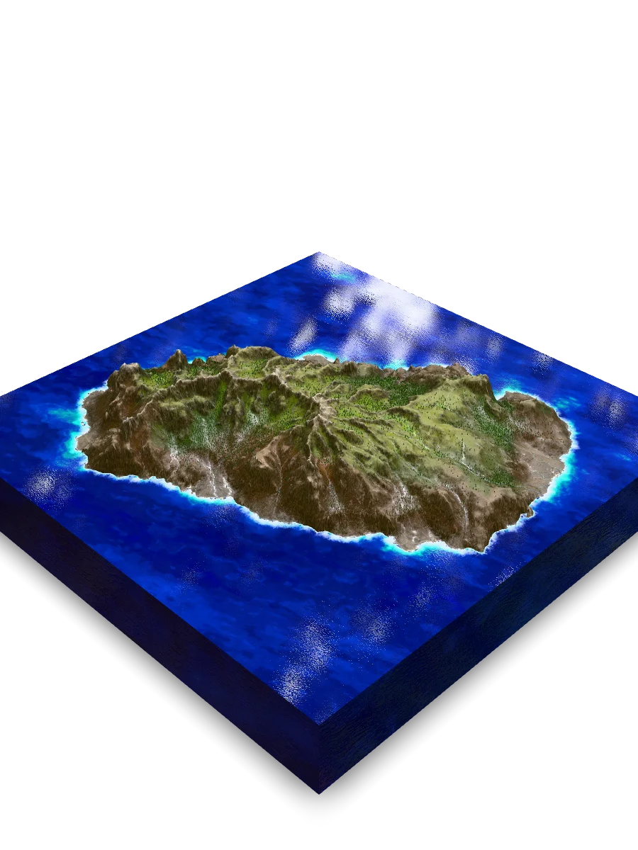
Saint Helena Island
The Final Harbor: An Island in History
From a vital "Tavern of the Ocean" to the world's most famous prison and the place of Napoleon's exile.
The island's history is inextricably linked to the sea. For centuries, its destiny shifted: from an uninhabited paradise full of fresh water to a strategic stopover on the route to India, and finally, to an impregnable prison for the most famous captive in history.
In the human imagination, St. Helena holds a dual position. For scientists, it is a living laboratory, a "Galapagos of the Atlantic," where evolution took its own course. For historians, it is a symbol of absolute isolation, the perfect prison, and the final act in the drama of Napoleon Bonaparte.
Symbol of Isolation
Its remoteness, thousands of kilometers from any continent, made the island the ideal place of confinement. It held not only Napoleon but also Boer prisoners during the Anglo-Boer War. The island became synonymous with "the end of the earth."
Symbol of Evolution
For science, the island is a treasure. Its unique flora and fauna, which evolved for millions of years without contact (and without mammals), allowed Charles Darwin and other scientists to see evolution in action.
The island's historical significance has ebbed and flowed. After its discovery, it was an important but quiet stopover. Its scientific importance began with Halley, but global fame exploded in 1815, turning it into the center of the world's attention. Today, its significance is rising again as a scientific and ecological hub.
A timeline of historical significance, showing the dramatic peak in global interest during Napoleon's exile (1815-1821).
Historical Significance Timeline (Relative Units)
- 1502 (Discovery): 1
- 1600s (Tavern of Ocean): 3
- 1677 (Halley): 5
- 1815 (Napoleon): 10
- 1836 (Darwin): 8
- Today (Science Hub): 7
Napoleon's Tomb
Located in the Valley of the Tomb, this empty tomb is the island’s most visited site. It stands as a powerful symbol of the six years of exile and the death of the era’s most influential figure, whose presence forever changed the island’s destiny. Although his remains were returned to France in 1840, the empty grave still serves as a solemn reminder of his final years on Saint Helena.
An Ark in the Ocean: Life in Isolation
How altitude and isolation created a unique ecosystem, nicknamed the "Galapagos of the Atlantic."
St. Helena is a world turned vertical. Due to the sharp change in altitude, several climate zones are packed into a tiny area: from sun-baked coastal cliffs to dense, humid cloud forests at the summit.
Today, the island's ecology is a story of a fragile balance disrupted by humans. Native life, which evolved for millions of years without threats, now fights for survival against aggressive "aliens".
The Endemic World
Unique flora like the Tree Fern (Dicksonia) and "Cabbage Trees" are living relics. These plants are perfectly adapted to local conditions, especially for intercepting moisture from the fog in the cloud forest, which waters the entire island.
The Invasive World
Species introduced by humans, especially New Zealand Flax (Phormium tenax) and Lantana, have become an ecological disaster. They have no natural predators and aggressively outcompete and "choke" the slow-growing endemic flora, taking over entire hillsides.
The scale of St. Helena's unique biodiversity is best understood as a paradox. The island is a global 'hotspot' of life, yet over 96% of its native habitat has vanished. How is this possible? The answer lies in millions of years of complete isolation, which created a dense concentration of unique species found nowhere else on Earth. This means that even the tiny, surviving fragments of its original ecosystems are irreplaceable, holding a concentration of life that gives them immense global importance.
St. Helena is home to approximately one-third of all the unique species found only across the UK's Overseas Territories and nowhere else on Earth.
Share of Endemic Species
- St. Helena Endemics: 502
- Rest of UK Territories Endemics: 1004 (a calculated value to visually represent the widely cited ~1/3 ratio)
Sandy Bay Valley
A grandiose erosional amphitheater showcasing the island's full geological power. Here, you can see the layers of lava and the stark transition from the wet highlands at its source to the dry scrublands near the black sand beach.
Time's Architect: The Birth of an Island
How a geological hotspot and millions of years of erosion sculpted the unique landscape of St. Helena.
The island's geological record is an epic drama. Imagine a giant volcano building itself over 14 million years, layer by layer of flowing, liquid lava, rising from the very ocean floor. When it finally 'fell asleep' 7 million years ago, two new architects took over - rain and wind. They began to 'sculpt' the island we see today.
The key to the island's present-day landscape is understanding how wind and water sculpted it. The volcano isn't one solid piece, it's a geological 'sandwich' of different rock layers. For 7 million years, erosion has been selective. It relentlessly washed away the softer, weaker layers, a process that has revealed and dramatically exposed the volcano's internal, much tougher 'skeleton'.
The Foundation: Soft Basalts
Dark alkali basalts make up the bulk of the island. They were formed from fluid lava flows. Being less resistant, they erode easily, forming the steep slopes and deep V-shaped valleys known as "guts".
The Spires: Hard Trachytes
Light-colored trachytes and phonolites are more viscous magma that cooled inside the volcano's fractures. They are extremely hard and resistant to erosion. As the softer basalt around them washed away, these intrusions were left standing as dramatic crags and peaks.
The island's climate is as polarized as its geology. The key factor is the orographic effect: the central mountain range intercepts all moisture, creating a "rain shadow" on the leeward side.
The Climatic Paradox: Windward Diana's Peak receives 4 times more rainfall than leeward Jamestown, which is just a few kilometers away.
Annual Rainfall (mm)
- Jamestown (Leeward Side): 250
- Diana's Peak (Windward Side): 1080
Diana's Peak
The highest point and the heart of the national park. Here, in the dense thickets of tree ferns, lives the cloud forest - the island's biological "ark." It is also the hydrological center, feeding all fresh water sources.
A Crossroads of Worlds
St. Helena is not just a rock in the ocean. It is a place where three great stories intertwine. The story of planetary forces that raised a volcano from the seabed. The story of fragile life, which in isolation created hundreds of unique forms. And the story of humanity, which turned this remote island into the stage for one of history's greatest finales.
To understand this island is to see how hard trachyte became the foundation for a cloud forest, which in turn provided water for ships that changed the world and guarded history's most famous prisoner. It is a living legacy where stone, life, and spirit are indivisible.
Quick Reference & Core Insights
Are invasive plants threatening the unique native flora of Saint Helena?
Aggressive invasive plant species pose an immediate ecological disaster to the island's slow-growing native flora. Introduced species like New Zealand Flax and Lantana completely lack natural predators within this isolated environment. Because they face no biological checks, these alien plants aggressively outcompete and choke native vegetation across entire hillsides. This ongoing takeover directly endangers unique relics like Tree Ferns and Cabbage Trees. Ultimately, this biological invasion disrupts a fragile balance that evolved in long isolation over millions of years.
How did volcanic erosion shape the unique landscape of Saint Helena?
Selective geological erosion shaped the island's landscape by deliberately exposing the ancient volcano's internal structural skeleton. For 7 million years since the final eruption, rain and wind relentlessly washed away the softer, less resistant rock layers. Specifically, fluid dark alkali basalts eroded easily into steep slopes and deep V-shaped valleys called guts. Meanwhile, highly resistant, viscous light-colored trachytes and phonolites remained standing as dramatic crags and peaks. This continuous, differential weathering successfully transformed a massive volcanic mass into a highly polarized vertical relief.
Why is Saint Helena's unique biodiversity under such extreme threat?
The remaining native biodiversity of Saint Helena Island is defined by a severe ecological paradox. Although the island serves as a critical global hotspot containing around one-third of all unique species across United Kingdom Overseas Territories, more than 96 percent of its native vegetation has been destroyed. This extreme habitat loss means that the tiny surviving fragments of the original ecosystem hold immense global value. Consequently, these irreplaceable remnants represent a highly concentrated, fragile environment where evolution took its own unique course.
Mnemosyne Protocol
The 3D scan captures the shape, but misses the soul.
Upload your memory to preserve the feeling of this place.