The Santorini Volcanic Caldera
Pompeii of the Aegean: The Lost City
The catastrophic eruption of ~1600 BC not only shaped the modern landscape but also became a pivotal event in human history. It destroyed a flourishing civilization but simultaneously preserved it for us, burying an entire city Akrotiri under a 40-meter layer of ash.
Santorini's story is one of constant transformation, where each new culture gave the island a new name and a new life, building upon the ruins of the last.
The 1600 BC catastrophe famously gave birth to the Western world's greatest myth, while simultaneously preserving an astonishing historical fact.
The Atlantis Myth
Many researchers believe Plato's description of Atlantis—a mighty naval power with a ring-shaped capital, destroyed in a single day by "floods and earthquakes" is a direct, inherited memory of the Minoan eruption.
The Akrotiri Fact
Unlike Pompeii, not a single human victim has been found at Akrotiri. Excavations show that the inhabitants, warned by a series of earthquakes, managed to conduct an organized evacuation before the final, devastating explosion.
After the "big bang" 3500-3600 years ago, the volcano did not die. It simply entered a new phase of its life. History has recorded numerous smaller eruptions that built the new islands of Palea Kameni and Nea Kameni in the caldera's center.
This chart shows the documented eruptions inside the caldera, starting from 197 BC. Each of these events added lava and land, gradually building the Kameni islands. The last such eruption occurred as recently as 1950.
Volcanic Activity History (Post-1600 BC)
- 197 BC: Event
- 47 AD: Event
- 726 AD: Event
- 1707 AD: Event
- 1866 AD: Event
- 1925 AD: Event
- 1950 AD: Event
Nea Kameni Island
The islands in the caldera's center are a 'natural laboratory,' composed of lifeless lava flows, some only decades old. Here, one can observe primary succession - the very first stage of colonization by lichens and mosses. Visiting its active fumaroles and hot springs feels like stepping onto a newborn planet, offering a raw look at the volcano's beating heart.
Life on Ash: The Unique Ecosystems
Santorini has no rivers, almost no rain, and a climate classified as a hot-summer Mediterranean (Csa) with strong semi-arid characteristics. Nevertheless, the islands are brimming with life. The secret to survival lies in the unique properties of the volcanic soil ("Theraic earth"), which has learned to pull water directly from the air.
For millennia, local farmers have used this phenomenon for "dry farming," creating a unique agricultural system. Santorini's famous grapevines are not irrigated - they drink the morning fog.
The island's plant life is clearly divided into two main zones: the wild, adapted for survival, and the cultivated, created by humans.
Phrygana
The dominant wild community. It's a formation of low-growing, drought-resistant, and often spiny semi-shrubs like thyme, sage, and cistus. This ecosystem covers most of the uncultivated slopes.
Agroecosystems
Unique, human-made landscapes. Primarily, these are the ancient vineyards with the Assyrtiko grape.
Living on an active volcano always involves risk. For Santorini, the danger comes not only from a potential eruption but from all the associated geological instability.
Santorini is subject to a complex of geological hazards. While a major volcanic eruption represents the maximum threat, a constant risk to infrastructure also comes from landslides on the steep caldera cliffs and seismic activity related to the region's tectonics.
Simplified Qualitative Hazard Assessment for Santorini
- Volcanic Activity: Relative Hazard Level 10
- Landslides & Rockfalls: Relative Hazard Level 9
- Seismic Activity: Relative Hazard Level 8
- Tsunami (Local): Relative Hazard Level 7
Thirasia Island
Thirasia is Thera's 'sister' island and the western wall of the very same caldera. It's often called 'Santorini as it was 50 years ago,' having preserved an untouched, authentic way of life free from mass tourism. On Thirasia, you'll see the same geology, but in a much calmer and more authentic atmosphere.
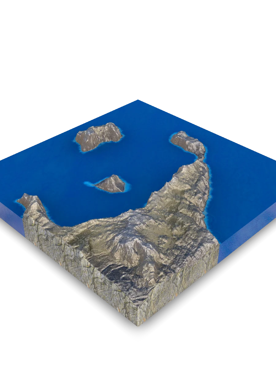
Born of Fire: Anatomy of a Caldera
Santorini is not just an island it's the rim of a giant, still-active volcano. Its famous crescent shape isn't a coastline, but the edge of a massive depression, or caldera, created by one of the most powerful eruptions in human history. The entire geology of this place is defined by two forces: the relentless movement of tectonic plates deep underground and catastrophic collapse at the surface.
Santorini's geological history is an endless cycle of creation and destruction. This process, which led to the modern caldera, can be broken down into four key stages.
The volcano's existence at this specific point is no accident. It was made possible by a unique convergence of two tectonic factors: a "fuel" source and a "pipeline" to deliver it.
The Tectonic "Conveyor"
Deep beneath the Aegean Sea, the African tectonic plate is plunging (subducting) beneath the Eurasian plate. At a depth of ~100 km, this process melts rock, generating vast amounts of magma - the "fuel" for the entire volcanic arc.
The "Stretch" Zone
Magma can't break through just anywhere. Santorini is located in a "back-arc basin" where the Earth's crust is actively stretching and thinning. This zone of weakness, riddled with deep faults, acts as a perfect "pipeline" for magma to escape to the surface.
When we look at the caldera walls, we aren't seeing solid rock, but a "layer cake" of products from different eruptions. This chart shows the approximate composition of the rocks that make up the islands.
The islands are composed not primarily of solid lava flows, but of "pyroclastics" a term for all materials explosively ejected during an eruption. This includes pumice, volcanic ash, and tuff, which form the famous white, yellow, and red layers in the cliffs.
Lithological Composition of the Santorini Islands
- Pyroclastic Deposits (pumice, tuff, ash): 60%
- Lava Flows & Domes (dacite, andesite): 30%
- Pre-Volcanic Basement (marble, schist): 10%
Profitis Ilias
Santorini's highest point (567 m) is not volcanic. It's the peak of the ancient, pre-volcanic island, composed of marble and schist, preserving a richer flora untouched by the volcanic soils. From its summit, you gain a unique 360-degree perspective, understanding the sheer scale of the caldera in contrast to this ancient remnant.
Where Beauty is Born of Catastrophe
The Santorini Volcanic Caldera is not just a landscape that became a tourism icon. It is a living archive, where a geological power capable of destroying civilizations simultaneously set a unique stage for new life. It is a place where deadly volcanic ash became fertile soil, and where the tragedy of a lost people formed the bedrock of one of humanity's greatest myths.
Here, the sheer cliffs are not just stone, but a record of a fiery history. The grapevine is not just a plant, but a symbol of ingenuity and survival. And the sunset over the caldera is a daily meditation on the legacy buried beneath the waves and the life that stubbornly continues to bloom on the ash.
Quick Reference & Core Insights
What are the colorful cliffs of the Santorini caldera made of?
The steep walls of the caldera are characterized by a distinct layered composition resulting from various historical volcanic eruptions. The visible cliffs are dominated by pyroclastic deposits such as pumice, tuff, and ash, while lava flows and dacite-andesite domes make up roughly a third of the simplified picture. A smaller pre-volcanic basement of marble and schist completes the sequence, recording a complex structural history of explosive materials and solid lava accumulation.
How do Santorini vineyards grow grapes without regular rain or rivers?
Farmers utilize specialized dry farming techniques that exploit the natural water-retaining properties of the local environment. The highly porous soil consists of ash and pumice gravel, acting like a sponge to quickly absorb night humidity and condensed sea fog. To safeguard this moisture from evaporation and protect the plants from wind, farmers weave the vines into unique low baskets called kouloura. This strategic methodology allows the cultivated agroecosystems to survive entirely without artificial irrigation or rivers.
Why were no human remains or bodies found in the ancient city of Akrotiri?
The absence of human remains points to a successful, pre-planned evacuation conducted before the final cataclysm. Archaeological evidence suggests that a series of preliminary earthquakes warned the ancient inhabitants of the impending volcanic disaster around 1600 BC. This early warning enabled the population to conduct an organized retreat before a forty-meter layer of ash buried the flourishing port city. Ultimately, this timely flight preserved human lives while completely entombing their frescoed buildings for future discovery.
Mnemosyne Protocol
The 3D scan captures the shape, but misses the soul.
Upload your memory to preserve the feeling of this place.