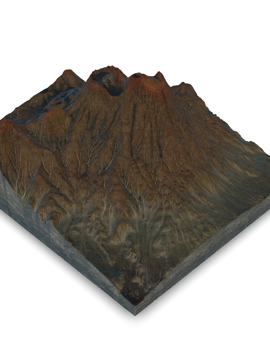
Lascar Volcano
Voice of the Ancestors: Cultural Legacy
To the indigenous Lickanantay people, Lascar is not a geological object, but a powerful living being, an ancestor, and a guardian (Mallku), with whom a spiritual bond has been maintained for millennia.
Lascar's modern history, especially since 1984, demonstrates its characteristic cyclical behavior, which culminated in the powerful 1993 eruption.
Lascar's significance to humans is twofold: it is simultaneously a sacred place and a source of constant danger, an object of worship and an object of scientific monitoring.
World of Myth & Spirit
In the Lickanantay cosmovision, Lascar is "Lasca" (Tongue), a portal connecting the human world to the subterranean "Inner Sun." Its activity is its breath or a reaction to human actions. Maintaining harmony with it is key to survival.
World of Science
For volcanologists, Lascar is a natural laboratory for studying subduction. For safety agencies, it is a source of hazards (ash, pyroclastic flows) requiring constant monitoring to protect aviation and local populations.
Risk assessment shows that Lascar is capable of events on various scales, from local ejections of rock "bombs" to transcontinental ash dispersal.
Maximum travel distance of various volcanic hazards. While rock "bombs" are local, ash plumes can cross continents.
Western (Extinct) Cone
The highest point of the massif (5,592 m), crowning an older, eroded stratovolcano. From here, a panoramic view opens up, overlooking both the smoking active crater and the vast Atacama Desert, allowing one to appreciate the full scale of the volcanic edifice.
Life on the Edge: The Puna Ecosystem
On the harsh slopes of Lascar, a unique high-altitude biome thrives: the Central Andean dry Puna. Here, life has adapted to the thin air, low temperatures, and near-total lack of water.
The distribution of life on the volcano strictly follows altitudinal zonation. With every kilometer up, conditions become more extreme, and plant communities change drastically.
Survival in the Puna requires unique adaptations. Both flora and fauna have developed incredible strategies to combat the cold, drought, and lack of oxygen.
Flora Adaptations
Plants minimize water and heat loss. Yareta (Azorella compacta) forms incredibly dense, hard cushions, while Tola (Parastrephia) has small, scaly, resin-coated leaves to prevent evaporation.
Fauna Adaptations
Animals are adapted to hypoxia. The blood of the Vicuña (Vicugna vicugna) contains hemoglobin with a higher affinity for oxygen, and Mountain Viscachas (rodents) live in colonies among the rocks, using their thick fur for camouflage and warmth.
The climate is the main factor defining life in the Puna. It is characterized not by the change of seasons, but by the colossal difference between day and night.
Average monthly temperatures at ~4,700 m. Frost is possible on any night of the year, and the daily temperature range regularly exceeds 25°C.
Active Crater
The heart of the volcano. An 800m-wide bowl where fumaroles are constantly active, venting gas. The walls are stained bright yellow and red from sulfur deposits and hydrothermal alteration. This is the zone of maximum hazard and direct connection to the magma chamber.
Earth Machine: Anatomy of a Volcano
Lascar Volcano is not just a mountain, but a dynamic expression of the tectonic forces shaping the Andes. Its geology and morphology are an open book on our planet's history.
Lascar's geological history is a multi-stage saga, recorded in layers of lava and ash. Its geological record (stratigraphy) shows how its vents ("eruptive centers") have "migrated" across the summit over more than 43,000 years.
The volcano's relief is constantly shaped by two opposing forces: constructive processes that build it up and destructive processes that slowly tear it down.
Constructive Forces
The volcano actively builds itself from within. Thick, viscous flows of lava form its framework, while high-speed avalanches of hot ash and gas (pyroclastic flows) create extensive fans at its base.
Destructive Forces
The extremely dry (hyper-arid) climate of the Atacama Desert is the chief sculptor. Daily temperature swings shatter rocks, winds transport ash, and rare, intense rainstorms trigger ancient mudflows (lahars) from past, wetter climates.
The composition of Lascar's rocks is key to understanding its magmatic system. This indicates complex processes of magma mixing and "layering" (differentiation) deep below the surface.
Approximate mineral composition of Lascar's rocks. This composition is typical for volcanoes, like Lascar, that were formed by one tectonic plate 'diving' beneath another (a subduction zone).
Pyroclastic Flow Deposits
Extensive, gently sloping fans at the volcano's base are formed by chaotic, high-speed mixtures of red-hot gas, ash, and rock. Channeled through valleys during catastrophic events like the 1993 eruption, these deposits settle to create the distinct, smooth planar surfaces visible on the slopes.
Crossroads of Worlds
Lascar Volcano is not just a smoking peak in the Atacama Desert. It is a place where worlds intersect. Here, geological time, measured in tens of thousands of years of crustal formation, meets fragile biological time, where a lichen grows one millimeter per year.
Here, the physical reality of tectonic plates and molten magma creates a unique stage upon which the drama of life unfolds: the survival of vicuñas and yaretas in extreme conditions. And above it all, the world of human meaning is built — myths of the Earth's "Tongue" and scientific data from satellites. Lascar is a living reminder of how, against the backdrop of eternal planetary forces, fragile life and the human spirit create their own unique, indivisible history.
Quick Reference & Core Insights
How big is Lascar Volcano and what rocks make up its structure?
Lascar Volcano is a massive active stratovolcano shaped by deep tectonic forces in the Andes. The volcanic edifice has a total volume of approximately 28.5 km³ and reaches a summit elevation of 5,592 m, sitting on a crustal thickness of 65-70 km. Its rocks are dominated by groundmass, with a substantial share of plagioclase, a smaller amount of pyroxenes, and only minimal oxides. Understanding these structural parameters helps scientists run a natural laboratory for studying subduction zones and monitoring direct hazards.
How do plants and animals survive the extreme high-altitude conditions on Lascar?
Plants and animals on the harsh slopes of Lascar develop incredible adaptations to combat severe cold, drought, and lack of oxygen. Specifically, the Yareta plant minimizes water and heat loss by forming dense, hard cushions, while the Vicuña has blood containing hemoglobin with a higher affinity for oxygen. These specialized strategies enable life to withstand an extreme daily temperature range of 25-30 °C and annual precipitation under 300 mm.
Can an eruption of Lascar Volcano affect cities thousands of kilometers away?
Yes, explosive events within Lascar's characteristic cyclical behavior can cause transcontinental impacts far beyond the local volcanic edifice. During the powerful 1993 eruption, accumulated pressure destroyed the lava dome and generated an ash plume reaching a height of 20-23 km. This massive plume resulted in ash dispersal that traveled 1,500 km to reach Buenos Aires. Consequently, these large-scale geological events pose widespread hazards that necessitate extensive monitoring to safeguard international aviation and distant populations.
Mnemosyne Protocol
The 3D scan captures the shape, but misses the soul.
Upload your memory to preserve the feeling of this place.