Komodo Island (Indonesia)
The Blood Pact
On these sun-drenched, razor-sharp ridges, humanity does not rule supreme. Instead, villagers share narrow pathways with a three-meter prehistoric predator, bound by an ancient pact of twin kinship. This spiritual alliance has shielded the world's largest lizard from extinction for centuries.
How did this extraordinary coexistence between a lethal predator and isolated villagers endure for centuries without bloodshed?
The island's cultural landscape is shaped by two coexisting worldviews, demonstrating how ancient myth and modern science can converge on the exact same goal of preservation.
ANCESTRAL WORSHIP (PRAFU)
Indigenous villagers practice a deep-rooted system of ancestor worship, leaving offerings at sacred altars and ancient trees to harmonize the worlds of humans, dragons, and nature.
THE SCIENTIFIC FRONTIER
Modern science classifies the giant lizard as an evolutionary relic of the Pleistocene. This framework strips away the mythology but reinforces conservation through rigorous ecological policy, international law, and systemic monitoring.
For centuries, the islanders lived in complete isolation alongside their formidable neighbors. But once the outside world breached this prehistoric sanctuary, how long did it take to establish formal protection?
Nearly seven decades passed between the dragon's initial scientific description and the formal creation of a national park to shield it from external exploitation.
Time Between Discovery and Protection
- Year 1910: Status - Rumors (First reports of giant lizards)
- Year 1912: Status - Science (Official zoological description)
- Year 1980: Status - Protection (National Park establishment)
Valley of the Dragons
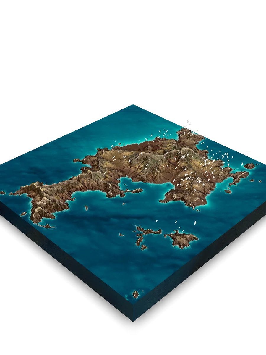
Deep in the lowlands lies the primeval domain of the world's largest lizard. Weighing up to 70 kilograms, these apex predators rule the sun-baked savannas like living dinosaurs. To escape the blistering midday heat, they dig deep subterranean burrows, while herds of deer and wild boar carve winding trails through the golden grass. This valley remains frozen in a forgotten geological epoch, a wilderness preserved not by chance, but by the islanders' ancestral choice to share their home with a lethal neighbor.
Vertical Sanctuaries
While human folklore whispers of sacred kinship, the physical struggle for survival unfolds across vertical gradients where life clings to scorched lowlands and misty peaks. Under an unforgiving equatorial sun, the flora and fauna of this Wallacean transition zone have developed remarkable adaptations to survive eight months of relentless drought.
Ascending from salt-sprayed shorelines to jagged summits, life morphs with elevation, dividing the island into three distinct, vertical ecological zones.
The archipelago's dramatic monsoonal climate drives a striking seasonal transformation, rewriting the visual texture and color palette of the entire landscape twice a year.
THE EMERALD DELUGE
From December to March, torrential monsoon rains spark an ecological explosion. Parched soils turn vibrant green, and dry, cracked ravines instantly transform into roaring torrents.
THE SCORCHED DROUGHT
For eight months, searing trade winds bake the hills. Grasslands turn to pale gold, while black fire scars pave the way for resilient fresh shoots in the next life cycle.
This vertical topography strictly dictates ecological boundaries, constraining where species can endure. How is the island's territory distributed among these specialized survival zones?
The proportional distribution of the dominant dry savanna and monsoon forest compared to other specialized oases.
Archipelago Biome Distribution
- Savanna & Monsoon Forest: 70% of the land area.
- Other Ecosystems (Mangroves & Quasi-Cloud Forests): 30% of the land area.
The Highland Oasis
Rising high above the arid lowlands is Gunung Ara, the island's highest summit at 808 meters. While the surrounding terrain bakes in a grueling eight-month drought, this peak performs an atmospheric miracle. Its elevation intercepts the condensation line, snagging low-hanging clouds on its jagged ridges. Here, specialized trees extract moisture directly from the daily fog, sustaining a hidden, emerald wonderland of mosses, ferns, and evergreen flora that could not survive anywhere else on this sun-scorched island.
The Tectonic Anvil
Beneath the thin, parched soil and golden grasslands lies a restless geological engine of colliding plates. This landscape is a fractured volcanic megastructure, forged in the Sunda Arc and sculpted by subduction: the slow, powerful collision where the oceanic crust dives beneath the continental plate.
By what geological sequence did these dramatic islands rise from the ocean to form the rugged, knife-edge peaks we see today?
When the monsoon deluge strikes this volcanic fortress, does the rock stand firm or disintegrate?
THE ANDESITIC SHIELD
Dense, heavy lava rock resists weathering. Forming the island's towering cliffs and craggy peaks, it acts as a sonic mirror, sharply echoing the howling trade winds and crashing surf.
THE ASHEN SPONGE
Porous layers of volcanic ash behave quite differently. They absorb torrential rains until they collapse in violent mudslides, and they swallow high-frequency sounds, casting an eerie, dead silence over deep gorges.
The primary sculptor of these jagged cliffs is not time, but the violent seasonal water cycle. How extreme is the precipitation shift that tests the island's volcanic integrity?
The terrain endures a dramatic weather whiplash, transitioning from a torrential monsoon deluge in January to an agonizing drought in August.
Extreme Monsoon Precipitation Shift
- January (Monsoon): 366 millimeters
- August (Drought): 10 millimeters
The Jagged Volcanic Spine
These dramatic ridges are the raw, visible scars of tectonic collision occurring miles beneath the ocean floor. Driven by the slow, powerful convergence of two massive plates, the seabed was buckled and thrust high above the waves. This steep, sun-scorched spine is regularly swept by intense dry-season grassfires, leaving behind scorched, pitch-black slopes. Yet, the moment monsoon rains arrive, these charcoal hills erupt into an undulating, brilliant sea of emerald grass, displaying an astonishing capacity for ecological rebirth.
The Code of the Primal Landscape
The volcanic foundation, the vertical ecosystems, and the mythic codes of the indigenous villagers are not isolated fragments. They are deeply intertwined. The physical geography directly sustains the survival of this legendary predator, while an ancient human culture acts as the ultimate shield for this delicate, timeless balance.
Quick Reference & Core Insights
How has local folklore helped protect the Komodo dragon?
An indigenous spiritual alliance acts as a cultural shield that has helped protect the world's largest lizard. According to local folklore, a sacred blood pact called Sebae forbids harming the three-meter dragons because they are considered the literal twin siblings of humans. This ancestral reverence supported long-standing coexistence in the lowlands, protecting the 70-kilogram predators long before modern science established a formal national park in 1980. Ultimately, this traditional belief system demonstrates how mythological codes can support long-term ecological conservation.
How do plants on Komodo Island survive the extreme eight-month drought?
The vertical ecological zones utilize distinct physical strategies to survive prolonged aridity. In the lowlands up to 500 meters, deciduous monsoon forests shed their leaves to conserve critical water supplies while fan palms punctuate the baked savanna. Above this boundary, the relict cloud forest on Gunung Ara intercepts the condensation line, extracting moisture directly from daily fog to sustain evergreen flora. This stratified moisture distribution ensures specialized ecosystems endure despite a severe annual weather whiplash.
What happens to Komodo Island during the heavy January monsoon rains?
The peak of the January monsoon triggers a rapid ecological rebirth across the parched landscape. Torrential precipitation of roughly 350+ millimeters quickly transforms dry, cracked ravines into roaring torrents and turns parched soils vibrant green. Concurrently, the intense moisture causes porous volcanic ash layers to give way in mudslides, while the scorched, pitch-black slopes from dry-season grassfires erupt into an undulating sea of emerald grass. This rapid hydrologic surge briefly rewrites the island's visual texture and resets its cyclical survival timeline.
Mnemosyne Protocol
The 3D scan captures the shape, but misses the soul.
Upload your memory to preserve the feeling of this place.